 By
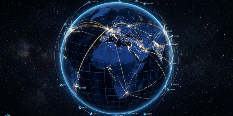
By A browser app that tracks 11,000+ live flights, 838+ satellites, global ship traffic, earthquakes, wildfires, and 800 public cameras on a photorealistic 3D globe went fully open source in August — and it just got a Model Context Protocol server. That means you can drop God’s Eye View into Claude Desktop or Codex and query the live planet from a chat window. The repo has 51,000+ GitHub stars. Here is what it does and how to wire it up.
What the Globe Actually Shows
God’s Eye View, built by Bilawal Sidhu, pulls real-time data from public infrastructure — no proprietary feeds, no paid data subscriptions for the core layers. Ten of the 13+ live data layers require zero API key: flights via OpenSky Network and adsb.lol, military traffic, 838+ satellites tracked via CelesTrak TLE data, earthquake feeds from USGS, wildfires and fire perimeters, CCTV cameras, radio stations, bikeshare, and space launches. The only hard requirements are an AISStream key for live ship positions and a Google Maps API key for the photorealistic 3D tile base layer. Sidhu calls that key “the whole entry fee.”
The rendering is worth noting: CesiumJS with custom GLSL shaders, 3D aircraft and ship models that swap in as the camera zooms, and optional sensor simulations including CRT, night vision, FLIR thermal, and Noir. It runs entirely in the browser. The license is MIT.
The MCP Server: 40 Tools, Any Agent
This is the part developers should care about. PR #896 merged a Model Context Protocol server into the repository with approximately 40 tools spanning aircraft, ships, satellites, earthquakes, fires, launches, CCTV cameras, routing, transit, traffic, weather, cyclones, terrain, infrastructure (submarine cables, datacenters, dams), military awareness, and situation briefs. You can wire it to Claude Desktop, Claude Code, the Codex CLI, Codex Desktop, or ChatGPT Desktop using either STDIO or local HTTP transport.
The setup is documented in docs/MCP_SETUP.md inside the repo:
- Run
npm run build:panelthennpm run dev - Add
server/mcp/stdio.jsto your AI client’s MCP server config - Restart the client fully
- Open a new chat and ask it to show you something: “What flights are over Ukraine right now?” or “Situation brief for the Taiwan Strait”
The globe opens inside the conversation. Spatial data becomes a first-class context type for any agent you are already using.
Self-Hosting in Four Commands
The repo ships with a doctor script that catches missing dependencies before startup. Node.js 24.14+ or 26.x is required.
git clone https://github.com/bilawalsidhu/gods-eye-view.git
cd gods-eye-view
npm ci
npm run doctor
npm run dev
Copy .env.example to .env and set GOOGLE_MAPS_API_KEY. Enable the Map Tiles API in Google Cloud Console first. A community Unraid app is available for homelab setups. The server-side proxy handles all key-gated APIs with SSRF protection and response caps so your credentials stay server-side.
Why Free Data Is Good Enough Now
The open data infrastructure powering this project is worth examining. OpenSky Network is a community ADS-B receiver network offering 400 credits per day for anonymous users, 4,000 for registered. CelesTrak has distributed orbital element sets freely for decades. USGS earthquake feeds are public. adsb.lol surfaces military ADS-B traffic. God’s Eye View is partly an existence proof: enterprise-grade spatial intelligence is achievable on a zero-dollar data budget if you know where to look.
A Note on Privacy
The project has drawn GitHub issues about the CCTV layer — whether live-relayed camera frames can contain identifiable faces or license plates. The author’s documented position: frames are relayed live with Cache-Control: no-store and are not persisted to disk, mirroring what the upstream public feeds already expose. The project explicitly does not include face recognition, named-person search, or individual tracking. License plate reader camera locations come from OpenStreetMap tags — only the map pin is shown, not video or plate reads.
Worth Running
The MCP ecosystem is mature enough that adding a spatial intelligence server to your agent setup is a one-afternoon project. With half of software companies running MCP in production, geospatial data is the obvious next context type to add. God’s Eye View is the only open-source project that delivers a full implementation — 3D globe, 13+ live layers, 40 MCP tools — under an MIT license. Fork it, extend it, or just run it and ask your agent where the nearest wildfire is.